-
Positioning:
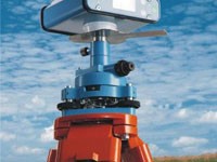
Hydrographic survey is about measuring water depth with an accurate positioning. Our positioning systems are based state of the art of Global Positioning System (GPS). All other augmentation techniques are being used including DGPS, WAAS, EGNOS and RTK.
-
Soundings:
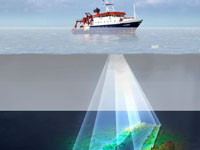
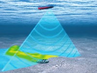
UGE is using wide spectrum of sounding equipment including Single Beam Echo Sounder, Dual Frequency Echo Sounder and Multibeam Echo Sounder. -
Bottom Imaging:
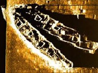
For identifying seabed structure and unknown targets, UGE is deploying Side Scan Sonar for acoustic imaging. -
Geophysical:
Sub-bottom profiler is used to determine the depth of expected rock layer in addition to sediment structure. -
Miscellanies:
All miscellanies equipment which are required for accurate hydrographic survey are included in UGE equipment (Motion Reference Unit, Sound Velocity Profiler , Tide gauge, .....) -
Previous Projects:
1-Bathymetric Survey for Pipeline in RasGareb for GAPESCO Company (Red Sea, 2003).
2-Bathymetric Survey and underwater photography Zafranah jetty berth for the Egyptian Navy and Zavkoa Company (Red Sea, 2005).
3-Bathymetric Survey of 300m pilot jetty and Piles in Alexandria Port (Mediterranean Sea, 2007).
4-Topographic surveying for Orca Dive Company (Mediterranean Sea, 2008).
5-Topographic surveying of slipway for MEDS boat yard (Mediterranean Sea, 2009).
6-Bathymetric Survey previous dredging for Egyptian navy syncrolift in Alexandria Port (Mediterranean Sea, 2010).
7-Bathymetric Survey for Pipeline in Sidi-Krier Power Station (Mediterranean Sea, 2011).
8-Bathymetric Survey for Pipeline in Abu-Qir Power Station (Mediterranean Sea, 2011).
9-Bathymetric Survey for Sedimentation basin in Abu-Qir Power Station (Mediterranean Sea, 2013).
10-Bathymetric Survey of 4000 m2 near Damietta Coasts for Desalination Plant (Mediterranean Sea, 2013).
11-Bathymetric Survey of 4000 m2 near Taba Coasts for Desalination Plant (Red Sea, 2013).
12-Bathymetric Survey of 4000 m2 near Salloum Coasts for Desalination Plant (Mediterranean Sea, 2013).
13-Bathymetric Survey and underwater photography of 2000 m2 near Halayib beach (Red Sea, 2013).
14-Bathymetric Survey and underwater photography of 2000 m2 near Shalateen beach (Red Sea, 2013).
15-Bathymetric Survey and underwater photography of 2000 m2 near Abu-Ramad beach (Red Sea, 2013).
16-Bathymetric Survey for Pipeline in Solvay Company (Mediterranean Sea, 2013).


